Understanding Climate Data: The Key to Smarter Risk and Resilience Strategies

Understanding Climate Data: The Key to Smarter Risk and Resilience Strategies Share Facebook Twitter Youtube Whatsapp Linkedin Decoding Climate Data: Making Sense of Forecasts, Trends, and Anomalies As climate risk analysts, we rely on climate data interpretation to assess vulnerabilities, predict extreme weather events, and develop adaptive strategies for businesses, governments, and communities. However, climate data is complex, and misinterpreting it can lead to flawed risk assessments and ineffective mitigation efforts. Understanding climate forecasts, long-term trends, and anomalies is crucial for data-driven decision-making in climate risk management. Understanding Climate Forecasts: The Science Behind Predictions Climate forecasts are derived from numerical weather prediction (NWP) models, which integrate real-time observational data from satellites, weather stations, ocean buoys, and remote sensors. These models use fluid dynamics and thermodynamics to simulate atmospheric behavior and generate predictions for temperature, precipitation, wind patterns, and extreme weather events. Key concepts in climate forecasting include: Deterministic vs. Probabilistic Forecasts – While short-term forecasts provide specific expected conditions (deterministic), long-range forecasts often rely on probability-based predictions due to inherent uncertainties in climate modeling. Climate vs. Weather Predictions – Weather forecasts predict short-term atmospheric changes (days to weeks), while climate models project long-term patterns over decades or centuries. Ensemble Forecasting – Running multiple simulations under slightly varied conditions helps assess the range of possible climate outcomes, increasing forecast reliability. For climate risk management, multi-model ensemble forecasts provide the best insights into regional climate shifts, helping policymakers and businesses prepare for changes in rainfall, heat waves, and extreme events. Identifying Climate Trends:Long-Term Patterns and Their Implications Long-term climate trends provide insights into shifts in temperature, precipitation patterns, and sea-level rise. These trends, analyzed over decades or centuries, are critical for infrastructure planning, agricultural adaptation, and insurance modeling. How We Analyze Climate Trends Data Normalization & Baseline Comparisons – We compare current climate variables with historical averages to detect long-term changes. Remote Sensing & Geospatial Analysis – Satellite imagery and GIS (Geographic Information Systems) help track land-use changes, deforestation, and desertification patterns. Climate Model Projections – Global and regional climate models (e.g., CMIP6, RCP scenarios) simulate future climate conditions based on different emission pathways. Real-World Applications of Climate Trends Analysis Energy Sector: Long-term temperature projections guide solar and wind energy investments in regions where climate variability may impact production. Agriculture: Changing precipitation trends influence crop selection and irrigation strategies to mitigate drought risks. Urban Development: Heat island effect assessments help design climate-resilient cities with better cooling infrastructure. By quantifying climate risks, organizations can integrate climate-smart policies and investments into their long-term strategies. Recognizing Climate Anomalies: Detecting Disruptions in Climate Patterns Climate anomalies refer to unexpected deviations from historical climate conditions, often linked to large-scale atmospheric phenomena such as El Niño and La Niña. These anomalies can cause abrupt weather shifts, leading to economic and environmental consequences. Key Indicators of Climate Anomalies Temperature Anomalies – Unusual warming or cooling trends in oceanic and atmospheric temperatures. Precipitation Extremes – Sudden droughts or floods outside normal variability. Atmospheric Oscillations – Disruptions in the North Atlantic Oscillation (NAO), Indian Ocean Dipole (IOD), or Pacific Decadal Oscillation (PDO) affecting global weather systems. Detecting Anomalies Using Data Analytics Machine Learning Models: AI-driven anomaly detection algorithms analyze past climate data to flag outlier patterns in temperature, precipitation, and storm activity. Big Data Processing: Climate databases (e.g., NOAA, ECMWF, IMD) provide vast datasets that allow analysts to compare real-time data with historical baselines. Extreme Weather Early Warning Systems: Predictive models use anomaly detection to trigger early warnings for cyclones, droughts, and heatwaves, enabling governments and businesses to take preventive action. The Role of Data Literacy in Climate Risk Management As a climate data analyst, I have seen firsthand how misinterpreting climate data leads to poor decision-making. Data literacy is essential for: Translating Complex Data into Actionable Insights – Decision-makers must understand probabilities, confidence intervals, and scenario modeling to make informed choices. Distinguishing Between Noise and Signals – Not every temperature spike or storm indicates a crisis; data smoothing and trend analysis help avoid reactionary decision-making. Building Adaptive Strategies – Data-driven insights enable the design of resilient supply chains, infrastructure projects, and financial instruments (like parametric insurance) to mitigate climate risks. Conclusion: Turning Climate Data Into Strategic Decisions Decoding climate data is not just about scientific curiosity—it’s about making informed, risk-aware decisions in an era of climate uncertainty. Whether planning infrastructure, designing insurance policies, or implementing sustainability initiatives, leveraging climate forecasts, trends, and anomaly detection can mitigate risks and unlock new opportunities. Organizations that embrace climate data analytics are better positioned to navigate the complexities of a changing climate, ensuring long-term resilience and sustainable growth.
How Real-time Weather Data Can Give Insurers an Edge in Managing Climate Risks

How Real-time Weather Data Can Give Insurers an Edge in Managing Climate Risks Share Facebook Twitter Youtube Whatsapp Linkedin In an era of unprecedented climate volatility, insurance companies face escalating risks driven by the destructive force of climate change. The increasing frequency and intensity of extreme weather events are damaging properties and livelihoods and threatening the stability of global economies. For insurers, the ability to manage these risks in real-time is no longer a luxury but a necessity. Parametric insurance—designed to trigger payouts based on specific weather parameters automatically—offers a highly effective solution for addressing the financial impacts of such events. However, to fully unlock the potential of parametric insurance, insurers must leverage real-time weather data to ensure that claims are processed with speed, accuracy, and transparency. By integrating advanced weather data, insurers can optimize their response to climate events to minimize delays and provide immediate financial relief to affected policyholders. According to a 2021 report by Aon, global economic losses from natural disasters amounted to $343 billion, with insured losses reaching $130 billion—a stark 18% increase from the previous year. The rising cost of climate-related damages underscores the need for more innovative risk management strategies. This article explores how the integration of real-time weather data is transforming parametric insurance and optimizing the claims process. Additionally, we will discuss how insurers can combine historical climate models and forward-looking data, such as CMIP6, to design more resilient policies that mitigate long-term climate risks. The Role of Real-time Weather Data in Parametric Insurance Insurance professionals designing parametric insurance products understand the importance of using real-time weather data. Unlike traditional indemnity-based insurance models, parametric insurance triggers payouts based on predefined weather events, such as wind speed, rainfall, or temperature, without requiring the submission of loss documentation. Real-time data ensures that parametric triggers are activated immediately once the event occurs. This enables insurers to deliver faster payouts and reduces the operational overhead associated with claims processing. Integrating weather APIs into underwriting platforms allows for seamless access to up-to-the-minute weather data, providing a robust foundation for parametric policies. In this context, data accuracy and immediacy are paramount. Insurers must trust that the data feeding into their systems is reliable and timely, which is where advanced technologies like IoT sensors, satellite data, and weather stations play a key role. Key Weather Parameters for Designing Parametric Insurance Claims Parametric insurance products require careful selection of weather parameters to ensure accurate payouts. The most commonly used weather triggers include rainfall, wind speed, and temperature. Rainfall data is particularly critical for policies in agriculture or flood insurance, where real-time measurements ensure accurate activation of claims. For hurricane or storm insurance, wind speed plays a significant role, and the ability to monitor it in real-time through weather stations or satellite-based platforms determines the exact moment a storm exceeds predefined thresholds. Similarly, extreme temperature fluctuations affect industries like agriculture and energy. With real-time temperature data, insurers have the capability to automate claims during heatwaves or frost. The integration of these weather parameters with parametric insurance models allows insurers to automate payouts and reduce claim disputes, while offering customers certainty and speed in the claims process. Advanced-data Sources: Real-time and Predictive Weather Data for Insurers For parametric insurance to function effectively, insurers must rely on accurate, high-frequency weather data. This data is gathered from various sources, including satellites, ground-based weather stations, and IoT sensors. Satellites offer a global perspective, delivering real-time updates on rainfall, wind patterns, and temperature shifts. This data is particularly useful for insurers covering large geographical areas. On a more localized scale, ground-based weather stations provide granular data, essential for regional parametric insurance products. IoT sensors, which can be installed on specific infrastructure or properties, offer real-time updates, especially useful for industries like agriculture or renewable energy where weather fluctuations directly affect output and thereby, financial performance. In addition to these real-time data sources, CMIP6 climate models offer long-term climate projections. For insurers, CMIP6 data allows for a more holistic approach to parametric insurance by integrating current data with long-term forecasts. It is beneficial in creating policies that not only respond to immediate conditions but also adapt to future climate risks. Platforms like ESGF facilitate the sharing and analysis of these datasets, while tools like CoG provide the necessary infrastructure for collaborative data management, ensuring consistent and scalable solutions for insurers. Incorporating Historical Data and CMIP6 for Long-term Risk Management While real-time data is vital for immediate parametric claims, forward-looking policies require a combination of historical weather data and climate projections like CMIP6. CMIP6 provides climate forecasts out to 2100 by modeling various socioeconomic pathways to assess different climate scenarios. For insurers, this data offers critical insights into how climate change will affect future weather patterns which is advantageous in forming underwriting strategies. The ability to downscale CMIP6 data to a more granular resolution makes it applicable for local and regional parametric insurance products. This allows insurers to adjust policy triggers based on predicted shifts in climate patterns, ensuring that their products remain relevant and adequately priced. For example, insurers offering flood insurance can use CMIP6 projections to anticipate the frequency and intensity of future storms, providing more accurate pricing and risk management. Benefits of Real-time Weather Data in Parametric Insurance Claims The integration of real-time weather data offers several distinct advantages for insurers designing parametric insurance products. First and foremost, real-time data enables faster claims processing. As soon as a triggering event occurs, payouts can be processed without delay thereby improving operational efficiency and minimizing disputes. Moreover, real-time weather data increases accuracy, ensuring that payouts are only triggered when legitimate weather events occur. This reduces the risk of fraudulent claims and enhances the insurer’s ability to price risk more effectively. Additionally, faster and more transparent claims processing leads to improved customer satisfaction. When policyholders know that claims will be settled immediately after a weather event, it builds trust in the insurer and encourages policy renewals. Finally, by automating the claims process with parametric triggers, insurers reduce the
Weather Index Insurance for Honduran Farmers

Case Study Weather Index Insurance for Honduran Farmers The Challenge Honduras relies heavily on agriculture, but climate risks increasingly threaten key export crops like coffee, sugarcane, tomato, and corn. Smallholder farmers, who are the backbone of this sector, face constant threats from extreme weather events like tropical cyclones and droughts. With crop failures and financial losses always looming, many farmers struggle to sustain their livelihoods. The lack of protection and inclusive support programs makes it clear: there’s an urgent need for innovative solutions to strengthen climate resilience and secure their future. The Approach UPL, in collaboration with WRMS, developed a Weather Index Insurance (WII) product tailored to the needs of Honduran farmers. This parametric solution provides coverage based on predefined weather events like excess rainfall and drought which eliminates the need for on-site loss assessments. The product uses real-time data from satellites and weather stations to trigger automatic payouts as soon as climate thresholds are breached to ensuring fast financial payouts. By integrating the WII product with UPL’s agricultural inputs, farmers receive comprehensive support during crop losses with need seed inputs without additional costs. To reduce the basis risk, the insurance model is calibrated to local weather conditions for accurate payouts. The partnership connects with local intermediaries to ensure farmers have access to credit, allowing them to invest in their crops without the fear of financial loss and new technology adoption. The Solution Parametric Insurance Model The WII product provides event-based coverage, with automated payouts triggered by specific weather conditions. This approach simplifies claims processing and ensure because of absence of on-site loss assessments. Comprehensive Coverage The insurance covers both excess rainfall and drought conditions to protect investments across crop cycles reducing risk exposure. Automated Payouts Real-time data triggers automated payouts, ensuring fast financial relief without lengthy claims procedures. Embedded Offering Combining insurance with UPL’s agricultural inputs creates a holistic solution that boosts productivity while mitigating climate risks. The Impact The WII program provided essential financial protection to smallholder farmers, enabling them to maintain productivity during extreme weather events. Quick payouts reduced vulnerability and promoted sustainable farming practices. By addressing the protection gap, the program contributed to long-term economic stability in Honduras’ agricultural sector. REACH OUT TO US
Building Climate Resilience in through Parametric Insurance Potato

Case Study Late Blight disease in Potato Background Late Blight is a lethal potato disease. In 2006 PepsiCo contract farmers lost 60 % of their crops due to this bane. It was difficult to extend cover under existing Crop Insurance programs due to moral hazard. What We Did Analyzed & found high correlations between location, humidity, and temperature. Created an index to cover blight risk specific to the region. Installed weather stations to minimize basic risk; critical for extending this kind of cover. Impact Successfully ran the project for 10+ years. Covered 10000+ potato farmers. Enabled risk-free investment of small & marginal farmers in smart technology. Demonstrated how insurance can be used by contract farming companies to sustain their farmer base. REACH OUT TO US
Building Climate Resilience in Haiti through Parametric Insurance

Case Study Building Climate Resilience in Haiti through Parametric Insurance The Challenge Haiti often experiences natural disasters such as hurricanes, floods, and droughts. However, it lacks reliable historical data and technology to manage these events. This makes it hard for insurance companies to create good risk management products in Haiti. As a result, smallholder farmers and communities are at risk of climate-related losses. Innovative, data-driven insurance solutions were essential to address these gaps and build resilience. The Approach Advanced Technology & Data Integration WRMS teamed up with the World Food Programme (WFP) to start a Weather Index Insurance (WII) program. This program helps protect Haitian farmers from climate risks, such as heavy rain and drought. WRMS used SecuSense, a modern Data Management System (DMS), to gather real-time climate data. It collects information from trusted sources like ECMWF and GPM. Remote sensing tools, including NDVI, MODIS, and Sentinel-2, allowed for precise weather tracking and crop health monitoring. Custom Calibration for Local Adaptation WRMS created a special insurance solution for Haiti’s weather and geography. The team regularly updated the model to ensure payouts match local climate events. These ongoing adjustments guaranteed that the product remained compliant with changing environmental and regulatory requirements while delivering swift and reliable financial relief to farmers. The Solution Implementation & Monitoring The Weather Index Insurance program was rolled out in the Grand Anse and Sud regions, initially covering 5,000 farmers. WRMS continuously monitored the weather to track and gather data. The system used real-time data to trigger automatic payouts when it reached certain climate thresholds. This provided quick financial cushion for farmers affected by droughts or heavy rain. It also allowed them to adjust to Haiti’s changing climate. Customize Insurance Products Custom calibration allowed the program to reflect localized weather conditions. WRMS aligned the insurance model with real-time climate data. This made payouts timely, clear, and suited to farmers’ needs. This flexibility helped WRMS adjust the solution as climate patterns changed. It became a dependable safety net for Haiti’s farming sector. The Impact By 2023, the program expanded to cover 7,500 farmers, providing immediate financial relief during climate events. WRMS aims to reach 50,000 farmers by 2024. They are also looking into new financial tools to help build resilience. This initiative proves how parametric insurance can strengthen climate resilience in vulnerable regions and presents a scalable model for other areas facing similar challenges. REACH OUT TO US
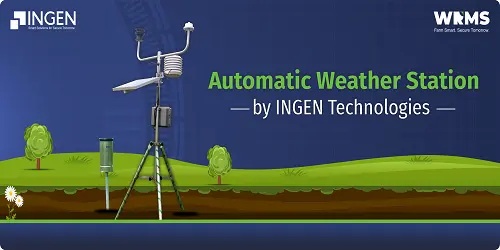
Automatic Weather Station by INGEN Technologies
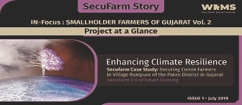
Securing Cumin Farmers In Village Rampara Of The Patan District In Gujarat
Structuring Risk Transfer Products: Challenges Actuaries and Businesses Face Dealing with Climate Change
Structuring Risk Transfer Products: Challanges Actuaries and Businesses Face Dealing with Climate Change Share Facebook Twitter Youtube Whatsapp Linkedin In today’s world, businesses across industries face increasingly complex and unpredictable risks. From natural disasters to cyber threats, climate change to geopolitical instability, managing risk has never been more challenging. Risk transfer products, like parametric insurance, catastrophe bonds, and reinsurance, offer new ways to reduce and manage risks. Behind these solutions lies a complex web of calculations, data models, and structuring that goes beyond simple risk mitigation. For both actuaries and businesses, creating risk transfer products is a task full of challenges and uncertainties. It requires careful balancing. Understanding these complexities is key to ensuring that these products are both effective and fairly priced. Let’s explore the complex world of creating risk transfer products. Actuaries and businesses face many challenges in this process. Understanding Risk Transfer Products Before diving into the challenges, let’s clarify what we mean by risk transfer products. These include parametric insurance, which pays out based on specific data like weather conditions. Catastrophe bonds help insurers transfer extreme event risk to capital markets. Other financial tools also move risk from one party to another. Risk transfer products are valuable because they offer businesses a predictable, efficient way to cover losses. However, their effectiveness depends heavily on how well actuaries structure and price them. The Actuarial Challenge: Structuring Risk Transfer Products Accurately Identifying Risk Exposure Understanding what risk someone transfers forms the foundation of any risk transfer product. Whether it’s drought affecting crop yields or a hurricane threatening infrastructure, actuaries must first quantify the risk. The challenge? Risks are not one-size-fits-all. For parametric insurance, specific parameters, such as rainfall below 50mm in a given time frame, determine the trigger. But businesses often have diverse, complex risk exposures. Identifying, isolating, and modeling these risks is a tough task. This is especially true for new risks like climate change or cyberattacks. In these cases, there is little or no historical data available. Businesses may not always fully understand their own risk exposure. That’s where actuaries play a crucial role—helping to translate complex risks into actionable, structured financial products. By working closely with actuaries, businesses can better understand their weaknesses and how to reduce them. Designing Trigger Mechanisms In parametric insurance, payouts are triggered by specific, measurable events. This could be a natural disaster, such as a flood or earthquake. It could also be a market index reaching a certain level. However, designing these triggers is an intricate balancing act. Data Collection and Validation A key challenge in risk transfer product design is accessing reliable, high-quality data. Parametric insurance uses real-time data from different sources. This includes satellite images, weather stations, and IoT devices. Actuaries use this data to model risks and set appropriate triggers. But the availability and accuracy of data can vary. In remote or underdeveloped regions, data gaps can lead to pricing inaccuracies or delays in payouts. As risks change quickly, such as climate change or political instability, current data may not capture all potential losses. Businesses rely on the timely and accurate delivery of these products. Any gaps in data can weaken trust in the solution. This challenge highlights the need to work with insurers who use advanced data technologies. They must also be able to validate this data for important business decisions. Challenges for Businesses: Aligning Risk with the Right Product Understanding the Complexity of Risk Transfer Products For businesses, especially those new to parametric insurance, the complexity of structuring these products can be daunting. Unlike traditional indemnity insurance, which assesses losses after an event, parametric products provide a more straightforward, data-triggered payout. However, this simplicity hides a lot of complexity behind the scenes. It includes the ways in which we set triggers, model risks, and determine pricing. This ensures that all key risks—ranging from equipment damage to climate disasters—are addressed within a single, coordinated policy. The key challenge for businesses is ensuring they fully understand how the product works and how it aligns with their risk profile. This is where clear communication is essential. Actuaries and product designers must explain the product structure in plain language, highlighting both the benefits and limitations. Businesses can then make informed decisions about whether the product truly fits their risk management needs. Customization for Specific Business Needs While parametric insurance offers a streamlined solution, businesses often face risks that are multifaceted. A mining company, for example, might want coverage not just for weather events but also for supply chain disruptions. Customizing risk transfer products to meet these specific needs, while ensuring that pricing remains competitive, is a significant challenge. Collaboration between businesses and actuaries is critical in the customization process. Actuaries need to adjust risk models to fit the business’s needs. They should do this without making the product too complex or increasing costs. Perceived vs. Actual Risk Businesses often feel frustrated when buying risk transfer products. This is mainly due to the difference between how much risk they think they have and the actual risk they face. A company may think it is more at risk from flooding than from windstorms. Later, it might find that wind poses a bigger financial threat. Without accurate risk assessments, businesses might purchase the wrong coverage, leaving them exposed if a crisis occurs. Actuarial expertise is invaluable here. By doing careful risk assessments and looking at past data, actuaries help businesses understand risk better. This ensures that the product they buy provides real protection. Technology’s Role in Structuring Risk Transfer Products Extensive data sets and AI are revolutionizing how we structure risk transfer products. Actuaries now have access to more detailed data than ever. This includes remote sensing technologies and real- time weather data streams. This improves the accuracy of risk models and allows for more dynamic pricing. However, relying on these technologies introduces new challenges. For one, data validation remains a critical issue—poor data can result in mispriced products or delayed payouts. Furthermore, as technology continues to evolve, keeping models updated
The Growing Need of Insurance Bundling to Manage Climate Risks in Sectors like Manufacturing and Agriculture

The Growing Need of Insurance Bundling to Manage Climate Risks in Sectors like Manufacturing and Agriculture Share Facebook Twitter Youtube Whatsapp Linkedin In industries like manufacturing, agriculture, and supply chain, risk management is critical. From protecting assets against physical damage to safeguarding operational processes against disruptions,there are countless insurance policies that businesses need to keep track of. With climate risks increasing and industries becoming more complex, managing various types of coverage can quickly become overwhelming. But what if there was a more streamlined way to handle these essential policies? This is where insurance bundling comes into play. By consolidating different types of insurance under one provider, businesses not only simplify policy management but also gain potential cost savings — a win-win, especially in sectors vulnerable to climate-related risks. In this guide, we’ll explore how bundling insurance can provide businesses with the comprehensive coverage they need, how it relates to managing climate risks, and the specific benefits it offers for industries like agriculture and supply chain management. Understanding Insurance Bundling for Industries What is Insurance Bundling for Businesses? Insurance bundling for businesses is the practice of purchasing multiple insurance policies—such as property, liability, business interruption, and climate risk insurance—from the same provider. By consolidating various coverage needs under one insurer, businesses can typically enjoy discounts and simplified administrative processes. This strategy works similarly to consumer insurance bundling (like combining home and auto insurance), but with more complexity. For industries like agriculture and supply chains, bundling can include everything from equipment insurance to protection against climate events, ensuring that all operational risks are covered under a single, cohesive plan. Bundling Climate Risk Insurance with Other Policies For industries that operate in high-risk areas, bundling climate risk insurance with other essential coverages—such as property and liability insurance—ensures that all potential hazards are accounted for. This allows businesses to approach their risk management strategy holistically, rather than piecemeal. Why Bundling Makes Sense for Businesses and Agriculture Cost Savings and Efficiency One of the primary benefits of bundling insurance policies is the potential for cost savings. Insurers often offer discounts when multiple policies are bundled together, and these discounts can be significant for large-scale operations like farms or logistics companies. For businesses with tight budgets or thin margins, these savings can make a big difference. Moreover, bundling reduces the administrative burden of managing multiple policies from different insurers. With a consolidated plan, businesses deal with a single provider, simplifying billing, claims processing, and policy updates. This streamlined process is especially beneficial for industries that need to frequently adjust their coverage, such as agriculture, where risks change with each season. Comprehensive Coverage for Complex Risks Bundling allows businesses to create a more comprehensive risk management plan. For example, an agricultural business might bundle crop insurance, property insurance, and climate risk insurance into one package. This ensures that all key risks—ranging from equipment damage to climate disasters—are addressed within a single, coordinated policy. For supply chain companies, bundling might include coverage for transportation, property damage, and business interruption due to natural disasters. This type of comprehensive coverage helps companies better prepare for disruptions and bounce back more quickly when they occur. Industries That Benefit Most from Insurance Bundling Agriculture Agriculture is one of the most vulnerable industries when it comes to climate risks. Farmers face the constant threat of droughts, floods, and other extreme weather events that can wipe out entire crops and devastate their livelihoods. Bundling insurance policies—such as crop insurance, property insurance, and climate risk insurance—helps ensure that farmers are protected from all angles. For example, a farmer might bundle their crop insurance with farm equipment insurance and climate risk insurance. This approach ensures that, in the event of a drought or flood, not only are their crops covered, but any damage to their essential equipment is also taken care of, allowing the farmer to recover more quickly and resume operations. Supply Chain Management Supply chain businesses, especially those that rely on global logistics, are highly exposed to climate risks. Natural disasters in one part of the world can cause delays that ripple through the entire supply chain, leading to financial losses and operational downtime. Bundling insurance policies, such as property, liability, transportation, and climate risk insurance, provides a buffer against these risks. For instance, a logistics company might bundle transportation insurance with business interruption coverage and climate risk insurance. This ensures that if a hurricane disrupts shipping lanes, the company is compensated for lost time and any damage to cargo, helping them maintain continuity. Manufacturing and Distribution Manufacturers also benefit from bundling insurance, particularly when dealing with physical assets and potential disruptions caused by climate events. Policies such as equipment insurance, climate risk insurance, and liability insurance can be bundled to protect factories from damage while ensuring that legal liabilities are also covered in the event of accidents. Customizing Your Insurance Bundle for Maximum Value Tailoring Coverage to Industry-Specific Risks When bundling insurance for industries like agriculture or supply chain management, it’s crucial to customize the package to address the specific risks each business faces. For example, an agricultural business in a flood-prone region might prioritize flood insurance, while a logistics company operating in areas prone to hurricanes might focus on business interruption coverage. By customizing bundles, businesses can ensure that they are not paying for unnecessary coverage while still getting the protection they need. Tailored bundles also allow for the inclusion of riders or add-ons, such as crop yield guarantees or equipment breakdown coverage, to further fine-tune the insurance package. Reviewing and Adjusting Coverage Regularly As industries evolve and climate risks change, it’s important for businesses to regularly review and adjust their bundled insurance policies. Agricultural businesses, for instance, should reassess their coverage at the start of each growing season, ensuring that their policies reflect the current risks and climate conditions. Supply chain businesses should likewise review their bundles whenever they expand into new regions or face shifting climate risks. Regular updates help ensure that businesses remain protected even as their operational
Financial inclusion & its Role in Realizing UN’s SDGs

Financial inclusion & its Role in Realizing UN’s SDGs Share Facebook Twitter Youtube Whatsapp Linkedin The Sustainable Development Goals (SDGs) are a set of 17 ambitious global objectives established by the United Nations to create a better and more sustainable future for everyone. These goals address a wide range of issues, including poverty, inequality, climate change, and economic growth. Financial inclusion, which refers to providing everyone with affordable financial services, especially those who are underserved or marginalized, plays a critical role in achieving these goals. The financial protection gap-where many individuals and businesses lack the financial services required to safeguard against risks-is a significant barrier to progress. Closing this gap through increased financial inclusion is essential for making substantial advancements toward the SDGs. The SDG Framework and the Role of Financial Inclusion Financial Inclusion and Poverty Reduction (SDG 1) One of the core objectives of the SDGs is to eradicate poverty in all its forms. Financial inclusion is a powerful tool in this fight. Access to financial services such as savings accounts, credit, insurance, and payment systems enables individuals to manage their finances more effectively, invest in their future, and protect themselves from economic shocks. For example, microfinance institutions in developing countries have provided small loans to millions of low-income individuals, helping them start businesses and improve their livelihoods. By bringing financial services to the poor, financial inclusion directly contributes to poverty reduction, making it a vital component of SDG 1. Financial Inclusion and Gender Equality (SDG 5) Gender equality is another key goal of the SDGs, and financial inclusion is crucial for empowering women economically. Women in many parts of the world face significant barriers to accessing financial services, including cultural norms, lack of financial literacy, and limited ownership of assets. Initiatives that promote financial inclusion for women, such as mobile banking and microfinance programs tailored to their needs, have proven effective in increasing their economic participation and independence. By ensuring that women have equal access to financial resources, financial inclusion supports the achievement of SDG 5. Financial Inclusion and Reduced Inequalities (SDG 10) Reducing inequalities within and among countries is central to the SDGs. Financial inclusion helps bridge the wealth gap by providing marginalized and underserved communities with the tools they need to improve their economic standing. For instance, digital financial services have expanded access to banking in remote and rural areas, where traditional banking infrastructure is often lacking. By bringing financial services to these communities, financial inclusion helps reduce economic disparities, contributing to the goals of SDG 10. Financial Inclusion and Sustainable Cities/Communities (SDG 11) Sustainable urban development is critical as the world’s population increasingly concentrates in cities. Financial inclusion supports community development by providing access to credit and investment for housing, infrastructure, and small businesses. Innovative financial services, such as community banking and urban microfinance, help ensure that even the poorest urban residents can contribute to and benefit from the growth of their cities. This financial empowerment is essential for building sustainable cities and communities, aligning with SDG 11. Financial Inclusion and Climate Action (SDG 13) Climate change poses a significant threat to global development, and financial inclusion can play a role in climate action. Financial services enable individuals and businesses to invest in climate-resilient infrastructure, adopt sustainable practices, and recover from climate-related disasters. Inclusive green finance initiatives, such as climate risk insurance and green bonds, provide the necessary financial tools to support mitigation and adaptation efforts. By integrating financial inclusion into climate strategies, we can help vulnerable populations build resilience and contribute to SDG 13. Frameworks for Achieving Financial Inclusion and the SDGs Regulatory and Policy Environments Creating an enabling regulatory and policy environment is crucial for advancing financial inclusion and, by extension, the SDGs. Governments need to implement policies that promote the development and adoption of financial services, especially for underserved populations. Effective financial inclusion policies can include regulations that support mobile banking, consumer protection laws, and incentives for financial institutions to serve low-income clients. These frameworks ensure that financial inclusion efforts are sustainable and scalable, making a meaningful impact on achieving the SDGs. Innovative Financial Products and Services Innovation is key to expanding access to financial services. New technologies, such as mobile banking, blockchain, and artificial intelligence, are revolutionizing the way financial services are delivered. These innovations make it possible to offer tailored financial products that meet the specific needs of underserved segments, such as microloans for small farmers or savings accounts for low-income families. By harnessing technology, we can overcome traditional barriers to financial inclusion and accelerate progress toward the SDGs. Public-Private Partnerships Collaboration between governments, businesses, and non-governmental organizations (NGOs) is essential for scaling financial inclusion initiatives. Public-private partnerships (PPPs) can leverage the strengths of each sector to develop and implement effective financial inclusion strategies. For example, a government might provide the regulatory framework, a financial institution the capital, and an NGO the local knowledge and outreach. Successful models of PPPs have demonstrated their ability to expand financial inclusion and drive progress toward the SDGs. Financial Literacy and Capability Education is a critical component of financial inclusion. Financial literacy programs empower individuals to understand and use financial services effectively, enabling them to make informed decisions about saving, investing, and managing debt. Building financial capability is especially important in underserved communities, where access to financial education may be limited. By investing in financial literacy, we can ensure that people have the knowledge and skills they need to benefit from financial services and contribute to the SDGs. Conclusion Financial inclusion is not just a goal in itself; it is a means to achieve broader development objectives, as outlined in the SDGs. By closing the financial protection gap, we can empower individuals and communities to overcome poverty, reduce inequalities, and build resilience to climate change. The collective effort of governments, businesses, and civil society is essential for advancing financial inclusion and, in turn, the SDGs. As we move forward, it is crucial to prioritize financial inclusion initiatives and ensure that they are integrated